Subject: World
Period: 1842 (dated)
Publication: Atlas Universel
Color: Hand Color
Size:
22 x 14 inches
55.9 x 35.6 cm
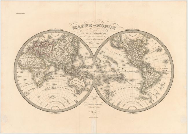
Handsome double hemisphere map shows the Western and Eastern Hemispheres in fine detail naming countries, rivers, harbors, seas and oceans. Many islands and island groups appear in the oceans and offshore regions around the world. The map also includes indications of the latest discoveries, brought back to Paris by navigators and explorers. The coasts of Australia have now been discovered and Tasmania, formerly Van Diemen's Land, is now shown separated from Australia by the Bass Strait. New island groups in the Pacific have been located and named, and a few areas in the Antarctic are beginning to take shape. America's Pacific Northwest coast and Alaska have also been explored and charted. This is a finely engraved map by Pierre Tardieu.
References:
Condition: B+
Wide, original margins with a few small spots and a centerfold separation in bottom blank margin that has been archivally repaired.