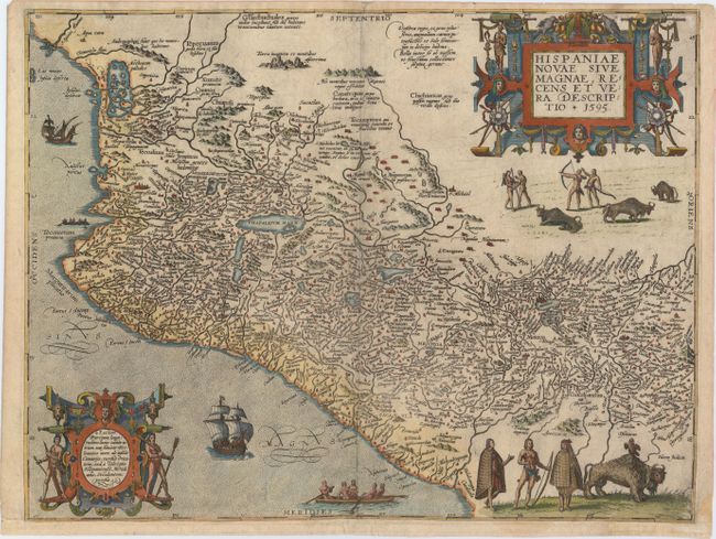
Subject: Mexico
Period: 1595 (dated)
Publication: Grands Voyages Part V
Color: Hand Color
Size:
17.3 x 13 inches
43.9 x 33 cm
This is a particularly interesting version of Ortelius' map of Mexico that was the prototype map of the region. It covers the Pacific coast from present-day Acapulco to about Mazatlan and inland to Mexico City, which is situated on a large lake. It is densely engraved with place names and shows the mining districts northwest of Mexico City. The map is elaborately decorated with engravings of Native Americans, bison, canoes, ships and two fabulous cartouches.
References: Garratt (TMC-9) pp. 2-11, #G5.
Condition: B+
A nice example with minor soiling and a few tiny tears in blank margins that have been archivally repaired. Professionally remargined at bottom with old paper and with a minor amount of neatline replaced in facsimile.