Catalog Archive
Auction 148, Lot 329

"Map of the City of Richmond-VA. Showing Present Corporation Lines as Established Dec. 6, 1906 Also Old Ward Boundaries. And New Precinct Lines",

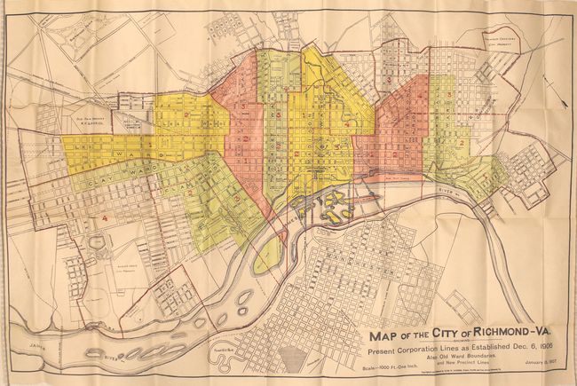
Subject: Richmond, Virginia

Period: 1907 (dated)

Publication:

Color: Printed Color

Size:
32.8 x 20.6 inches
83.3 x 52.3 cm
Download High Resolution Image
(or just click on image to launch the Zoom viewer)

This map of Richmond depicts the newly established corporate limits published a month after the boundary lines were redrawn. Seven different wards are highlighted and several additional locations are identified including Maymont, Belle Isle, the Old Fair Grounds and Capitol Square. Published by Clyde Saunders at Twelfth and Cary Streets. Folds into tan paper wrappers (3.5 x 6.6").

References:

Condition: A

Issued folding on watermarked paper with a few short splits at fold intersections and a few light pencil notations in the image.

Estimate: $100 - $130

Sold for: $75

Closed on 2/19/2014

Archived