Catalog Archive
Auction 148, Lot 309

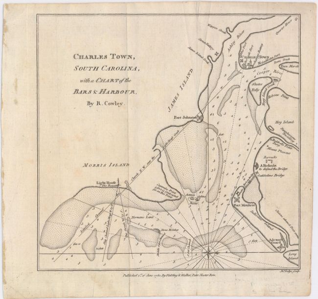
"Charles Town, South Carolina, with a Chart of the Bars & Harbour", Lodge, John

Subject: Colonial South Carolina

Period: 1780 (dated)

Publication: Westminster Magazine

Color: Black & White

Size:
7.6 x 7.4 inches
19.3 x 18.8 cm
Download High Resolution Image
(or just click on image to launch the Zoom viewer)

This Revolutionary War period chart of Charleston was published just one month after British General Sir Henry Clinton's successful siege on Charleston. The chart gave the British readership of Westminster Magazine a glimpse of the war. In addition to a note identifying Clintons advanc'd Post, the map includes two British warships, the Acteon and the Sphinx, marking the Battle of Sullivan's Island. It also features military forts and installations, a lighthouse, depth soundings, and details about bridges and channels. The map is oriented with north to the right.

References: Jolly #WEST-8.

Condition: B+

Issued folding with some minor soiling and a couple of extraneous creases.

Estimate: $500 - $650

Sold for: $325

Closed on 2/19/2014

Archived