Subject: Cape Cod, Massachusetts
Period: 1889-96 (dated)
Publication:
Color: Black & White
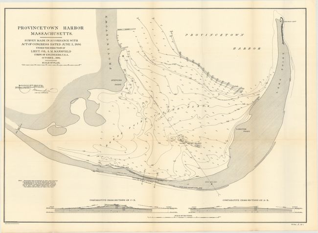
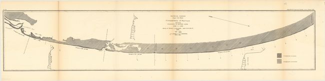
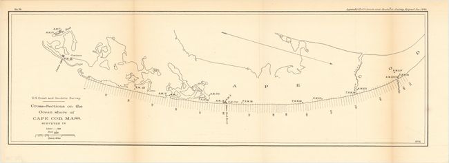
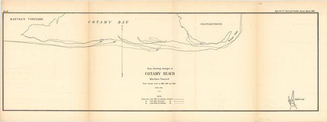
These four maps show the surveying efforts in the area about 25 years before the Cape Cod canal was established in 1914. The map of Provincetown identifies the high and low water lines, shows numerous soundings and docks, and was drawn under the direction of Lieut. Col. S.M. Mansfield of the Corps of Engineers in 1896. The other three maps demonstrate the shifting shore lines and were included in the 1889 Coast and Geodetic Survey report.
A. Provincetown Harbor Massachusetts..., by S.M. Mansfield, dated 1896 (27.5 x 19.8").
B. Physical Survey Cape Cod Mass. Comparison of Surveys Showing Changes in Shore Line, 1848-1888 , by U.S. Coast and Geodetic Survey, dated 1889 (42.4 x 8.3").
C. Cross-Sections on the Ocean Shore of Cape Cod, Mass. Surveyed in 1887-88, by U.S. Coast and Geodetic Survey, dated 1889 (25.5 x 8.3").
D. Map Showing Changes in Cotamy Beach Martha's Vineyard from Surveys Made in 1886, 1887 and 1889, by U.S. Coast and Geodetic Survey , dated 1889 (29.3 x 9.3").
References:
Condition: A
Issued folding, the maps are clean and bright with only light toning along a few folds and minor offsetting in map D.