Catalog Archive
Auction 148, Lot 263

"Map Showing Location of Pottawattamie Reserve; Lands in Kansas Belonging to Atchison Topeka & Santa Fe R.R. Co.",

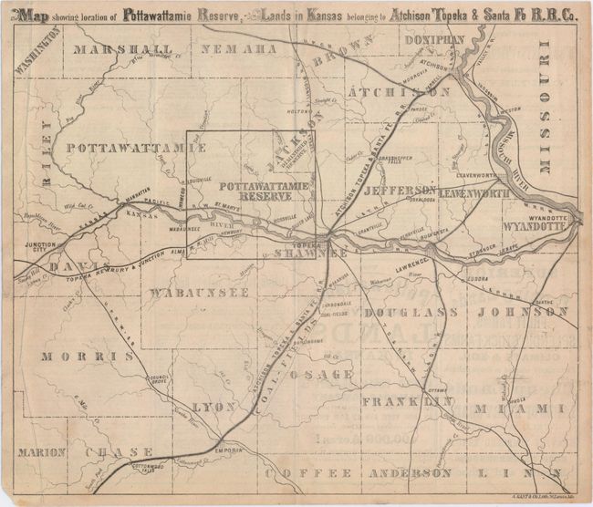
Subject: Eastern Kansas

Period: 1869 (circa)

Publication:

Color: Black & White

Size:
12.4 x 10.6 inches
31.5 x 26.9 cm
Download High Resolution Image
(or just click on image to launch the Zoom viewer)

This promotional brochure extols the benefits of land in the Pottawattamie Reserve, an area just west of Topeka. In addition to the reserve area owned by the Atchison Topeka & Santa Fe railroad company, the map shows county boundaries, towns and cities, and several railroad lines. The verso describes the land for sale and the many benefits of the area. Lithographed by A. Gast & Co. in St. Louis.

References:

Condition: B+

Issued folding and now flattened with an extraneous crease at left and some light text show-through from verso.

Estimate: $250 - $325

Sold for: $180

Closed on 2/19/2014

Archived