Subject: World
Period: 1682 (published)
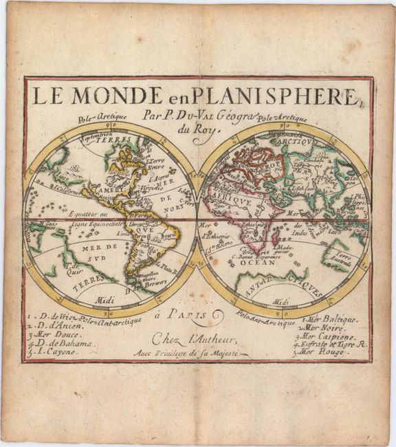
Publication: Le Monde ou la Geographie Universelle
Color: Hand Color
Size:
5 x 4.1 inches
12.7 x 10.4 cm
This is the first world map created by Duval, first published in 1658. This miniature double-hemisphere map depicts the island of California with Iesso extending between Asia and North America. There are a few place names noted on each continent, including Virginie and Canada in North America. The western outline of Terre Australe is depicted, and a large, partially delineated Terres Antarctiques is shown. The map was updated in 1672 with a numbered key at bottom identifying various straits, seas, and rivers. Pierre Duval was Nicolas Sanson's nephew and pupil. He published a wide range of atlases and individual maps including a fine miniature world geography with many of the maps based on Sanson.
References: Shirley #405; King (2nd ed) pp. 132-135; Pastoureau, Duval XI Fa.
Condition: B+
A nice impression on watermarked paper with attractive old color that has been partially refreshed There is light toning along centerfold and sheet edges, a few small spots of foxing, and a professionally repaired centerfold separation that enters 1.5" into map at top.