Subject: United States
Period: 1875 (circa)
Publication:
Color: Printed Color
Size:
22.1 x 16.8 inches
56.1 x 42.7 cm
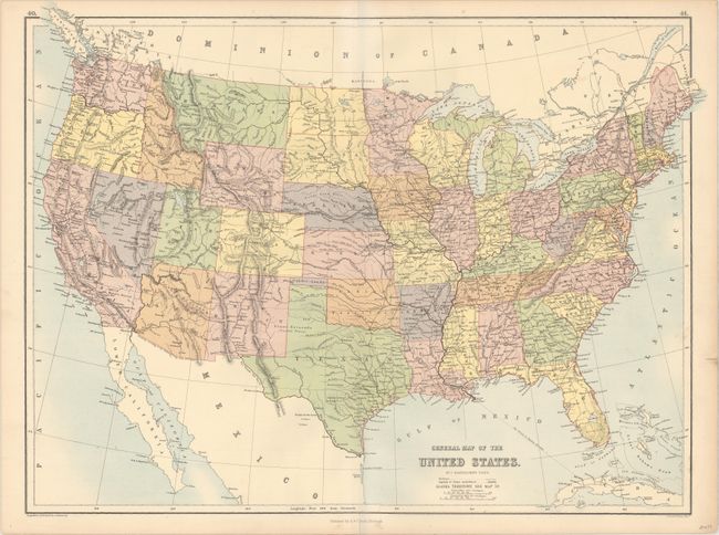
This rare, if not scarce, map is unique for its depiction of the Territory of Pembina where North Dakota exists today. There was much interest in dividing Dakota Territory in the mid-1870s, and in the Dec. 22nd, 1874 edition of the Sacramento Daily Union under "News of the Morning" is a one sentence note "The Pembina Territory Bill was revived on motion of Boreman" in the U.S. Senate. Bartholomew apparently wanted the jump on other map makers, and thus shows Pembina as a territory with a border with Dakota more to the south than exists between North and South Dakota today. However, the color of Pembina was not changed with Dakota to the south and the lettering was not in bold type, which would indicate some uncertainty with its status. In later years Bartholomew would show the area to become North Dakota as the Territory of Huron and Lincoln Territory. North and South Dakota were eventually created in 1889.
References:
Condition: A
A clean and bright example with one short, closed edge tear confined to the right blank margin.