Subject: Geography Books
Period: 1853-77 (published)
Publication:
Color: Hand Color
Size:
10 x 12 inches
25.4 x 30.5 cm
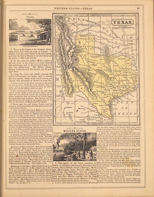
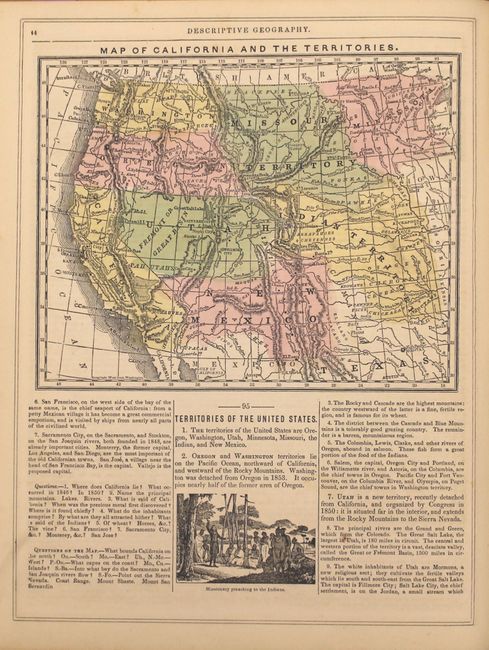
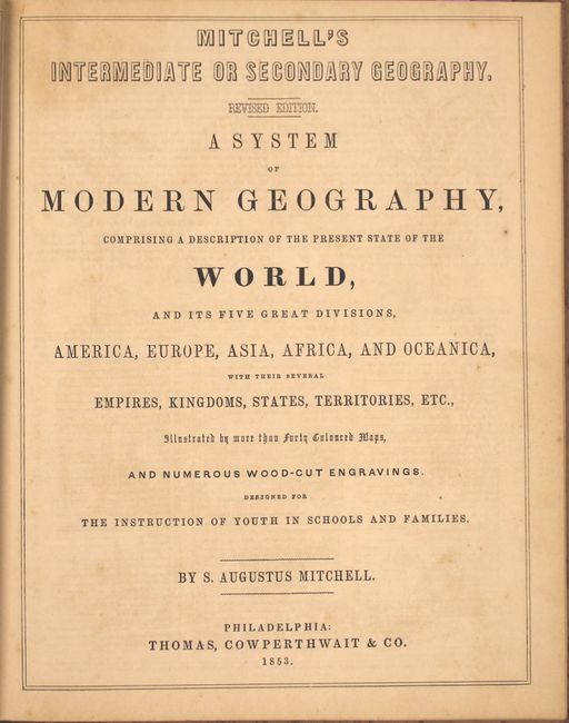
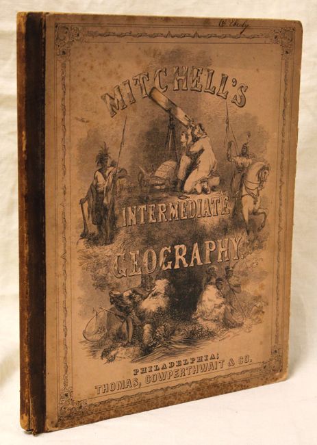
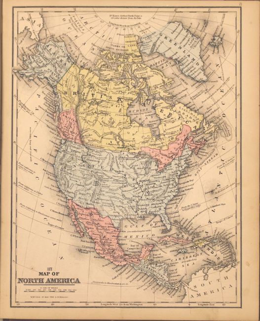
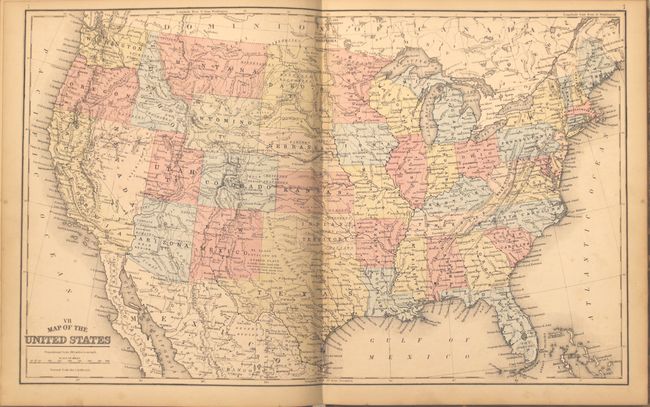
A. Mitchell's Intermediate or Secondary Geography. Revised Edition. A System of Modern Geography..., published 1853. This complete example of Mitchell's Geography was published for "the instruction of Youth in Schools and Families." It is richly illustrated with wood engraved vignettes, diagrams and statistics. Includes maps of North America, South America, Europe, Asia, Africa, Oceanica, and all of the states and territories of the United States. It also features a great map of the west that is similar to the atlas version from the same period. Washington and Oregon territories extend to the Continental Divide, Utah and New Mexico are in their large configuration. A very large Indian Territory extends north to the large Missouri Territory that in turn continues to the Canadian border, and stretches between the Continental Divide and the oversized Minnesota Territory. Hardbound with pictorial paper covers, frontis, title page, text and maps, advertisements, 82 pp. Condition: All of the maps have very nice original full hand coloring with some very light toning and a few minor spots of foxing. There is a previous owner's stamp on the inside front cover and the endpapers are foxed with a damp stain at top. The hinges are starting and the covers are worn and stained.
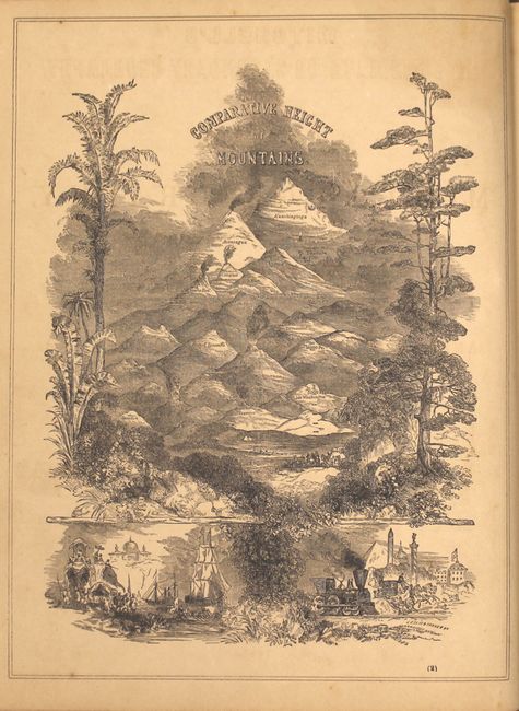
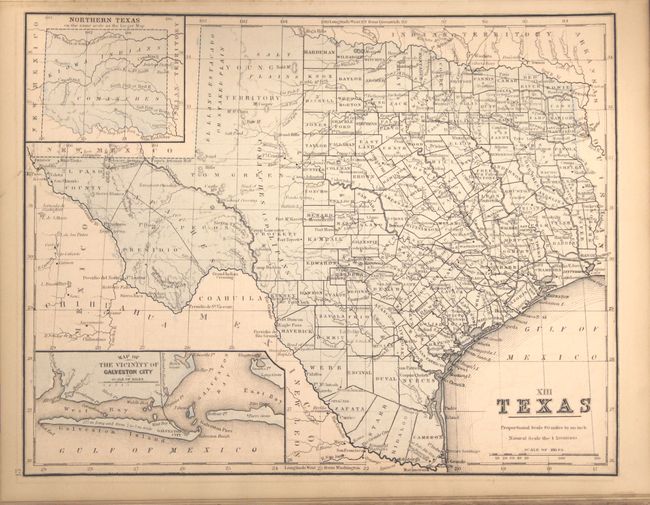
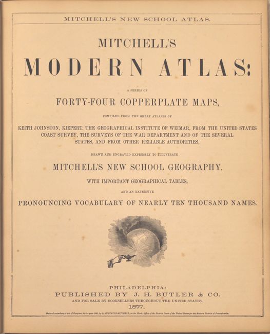
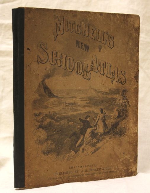
B. Mitchell's Modern Atlas: a Series of Forty-Four Copperplate Maps..., published 1877. A very nice example published by J.H. Butler & Company of Philadelphia. The 44 maps are hand colored and printed on both sides. This world atlas contains 15 maps of US interest including a nice example of the United States and "XIII Texas." Hardbound with pictorial paper over boards featuring children on a hillside overlooking a small sea village with erupting volcano. Condition: All of the maps have very nice original full hand coloring with light toning and a few minor spots of foxing. Covers are worn and stained and the perished spine has been replaced with binder's tape.
References:
Condition: B+
See descriptions above.