Catalog Archive
Auction 147, Lot 682

"Philips' New Map of Southern Africa, Including the Cape Colony, Natal, British Kaffraria, & the Diamond Fields", Philip, George

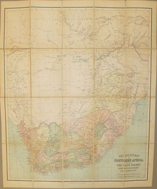
Subject: Southern Africa

Period: 1880 (circa)

Publication:

Color: Printed Color

Size:
20.2 x 24.2 inches
51.3 x 61.5 cm
Download High Resolution Image
(or just click on image to launch the Zoom viewer)

This detailed map, published for the British tourist, depicts Southern Africa below the Tropic of Capricorn. It is filled with detail of the settlements in the region including the Transvaal Republic, the Orange River Free State and native tribes. The land to the north is noted as simply bushmen. The map is dissected and backed with linen. Folds into red embossed cloth boards with gilt title on front cover. Published by George Philip & Son.

References:

Condition: B

Light soiling and scattered foxing. Covers show minor wear.

Estimate: $180 - $220

Sold for: $110

Closed on 11/20/2013

Archived