Subject: Africa
Period: 1783 (dated)
Publication: An Universal Atlas
Color: Hand Color
Size:
14.3 x 14.6 inches
36.3 x 37.1 cm
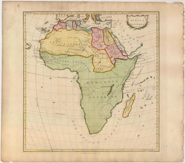
This attractive map of Africa shows the ancient geography with little inland detail. There is a lake named Agizymba in the central portion of the country which most likely refers to present-day Lake Victoria. The Mountains of the Moon (Lunae M) appear north of the Equator, with two lakes depicted as the source of the Nile River. A large portion of the continent towards the west is labeled Terrae Incognitae. Adorned by a decorative title cartouche. This map was published in Thomas Stackhouse's Universal Atlas, which contained 40 maps engraved by Neele.
References: Shirley (BL Atlases) T.STA-1b.
Condition: B+
On watermarked paper with ample margins. There is faint offsetting in the image and a damp stain that just enters neatline at top.