Subject: India
Period: 1820 (dated)
Publication: A Complete Genealogical, Historical, Chronological, And Geographical Atlas...
Color: Hand Color
Size:
12.8 x 13.2 inches
32.5 x 33.5 cm
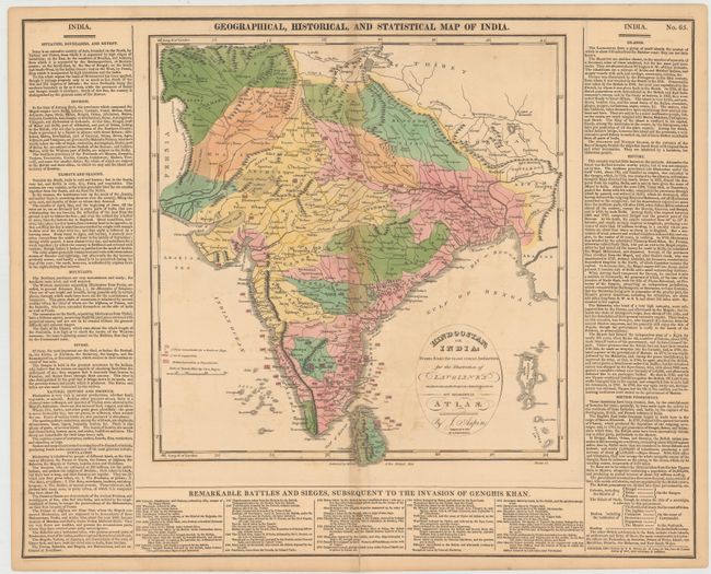
This is the first American edition of this informative map of India, updated from the London edition of 1817 and published by M. Carey & Son. In addition to showing political divisions, towns, rivers, mountains, and other topographical features, the map notes the dates and locations of a plethora of battles and naval engagements as well as marking British possessions and dependencies. The map is surrounded by English text describing the nation's geographical features and history, with a list at bottom detailing the specifics of some of the battles shown in the map above. An alternate title, Hindoostan; or, India: Drawn from the Most Recent Authorities, for the Illustration of Lavoisne's Genealogical, Historical, Chronological, and Geographical Atlas, appears in a cartouche within the map. Originally engraved by Kneass and printed by T.H. Palmer. With surrounding text, the sheet measures 20.7 x 16.6."
References:
Condition: B
Original color with light toning along the centerfold and minor offsetting. There is a centerfold separation at top that just enters the neatline of map image and another at bottom that enters about 1" into the text, both of which have been closed on verso with archival tape. Inches away, a tear measuring approximately 2" also enters the text and has also been closed on verso.