Catalog Archive
Auction 147, Lot 579

"Facies Palaestinae ex Monumentis Veteribus", Reland, Adrien
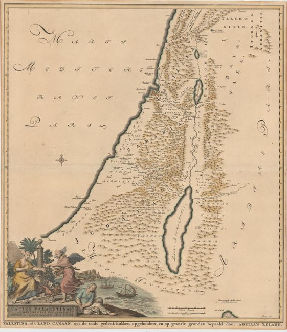
Subject: Holy Land

Period: 1714 (published)

Publication: Palaestina ex Monumentis Veteribus Illustrata

Color: Hand Color

Size:
19.4 x 21.9 inches
49.3 x 55.6 cm
Download High Resolution Image
(or just click on image to launch the Zoom viewer)

This map shows the Holy Land in Roman times divided into Galilee, Samaria and Judea with Peraea Batanaea on the west side of the Jordan River. Although Reland uses the traditional format for his map of the Holy Land, he excludes the fanciful names and imaginary rivers from previous maps. The allegorical title cartouche features a terrestrial globe, mapmaker's tools, and Judea in chains, with the port of Jaffa in the background. Engraved by Broen.

References: Laor #643; Nebenzahl (Holy Land) #54.

Condition: B+

A fine impression with attractive color and light toning. Narrow margins, as issued.

Estimate: $200 - $240

Sold for: $150

Closed on 11/20/2013

Archived