Subject: South Pole
Period: 1841 (dated)
Publication:
Color: Black & White
Size:
6 x 7.4 inches
15.2 x 18.8 cm
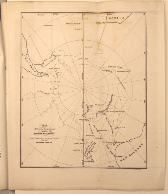
This basic map of Antarctica is centered on the longitude of New Zealand and shows portions of New Holland, Africa and South America. Portions of the continent are shown including Enderby’s Land, Palmer’s Land, Alexander’s Land and South Victoria. The routes of several explorers are also shown including Cook, Ross, Wilkes and Weddel. The map is included in the complete November 1841 edition of The Monthly Chronicle of Events, Discoveries, Improvements and Opinions. This obscure publication included an article and letter from Captain James Ross who was then on voyage of discovery in the Antarctic, and the article reported that he had reached the highest latitude in the Southern Hemisphere. 95 pp. Published by Bradbury & Soden in Boston.
References:
Condition: B
The map has a little toning and offsetting primarily at top. The text has scattered foxing and the back paper wrapper is detached.