Subject: Mediterranean
Period: 1665 (circa)
Publication:
Color: Hand Color
Size:
21.9 x 13.4 inches
55.6 x 34 cm
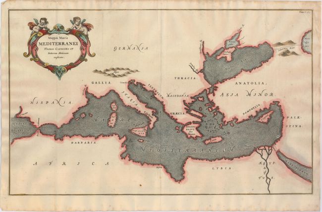
An unusual map from Kircher's masterpiece, the first serious effort to describe the physical makeup of the earth, proposing theories (sometimes fantastic) in the areas of physics, geography, geology, and chemistry. The map is devoid of political information and instead focuses entirely on ocean currents in the Mediterranean Sea. The map extends to include the Black Sea and parts of the Caspian and Red Sea. Kircher's theories included the notion that the world's oceans were all interconnected and thus this map depicts subterranean tunnels connecting the oceans and seas. The decorative title cartouche is surmounted by two putti.
References:
Condition: B+
Watermarked paper with a few small spots, a printer's crease adjacent to centerfold, and a tiny hole at bottom of map caused by a paper flaw.