Subject: Switzerland
Period: 1855 (dated)
Publication:
Color: Hand Color
Size:
36 x 25.5 inches
91.4 x 64.8 cm
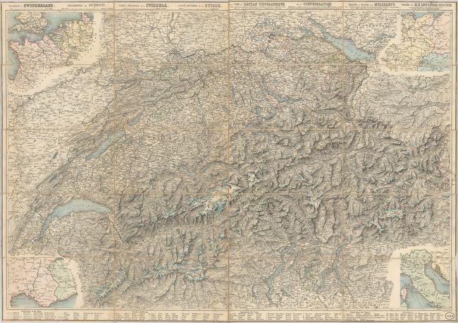
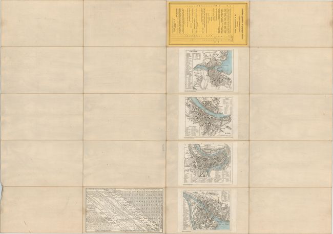
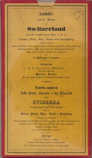
This densely engraved map of Switzerland is translated into four languages: English, German, Italian and French. The topography of the land is well-depicted, and a detailed legend at bottom identifies everything from towns of various sizes, railroads, post roads, horse trails, canals, tunnels, and forts to pilgrimages, ruins, cheese factories, caverns, battle fields, and more. In the four corners are inset maps of the neighboring regions. On verso are miniature bird's-eye plans of Geneva, Basel, Bern and Zurich as well as a table of distances between towns and other statistical information. Engraved by H. H. Mullhaupt and published by H. F. Leuthold. Dissected and mounted on linen and housed in a paper board slipcase.
References:
Condition: B+
Very light soiling and wear. Slipcase is lightly soiled and worn.