Catalog Archive
Auction 147, Lot 451

"Carte Geologique du Departement de la Seine-Inferieure et des Parties Limitrophes des Departements Voisins", Tardieu, Ambroise

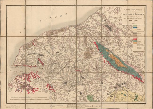
Subject: Northern France

Period: 1832 (dated)

Publication:

Color: Hand Color

Size:
31.1 x 22.1 inches
79 x 56.1 cm
Download High Resolution Image
(or just click on image to launch the Zoom viewer)

This geological map depicts a portion of Haute-Normandie, with Rouen located roughly at center. The map shows the mouth of the Seine River and extends east to Beauvais (in the region of Picardie) and as far north as Dieppe and Eu. A color-coded legend identifies 10 different geological units, including gypsum and chalk. Scores of towns, roads and rivers are also shown. Published by Ant. Passy. Dissected and mounted on linen with a hand-written paper label on verso.

References:

Condition: B+

Original color with light soiling. A few of the dissected panels are separating from the linen in some spots.

Estimate: $120 - $150

Sold for: $50

Closed on 11/20/2013

Archived