Catalog Archive
Auction 147, Lot 447

"Tabula Europae III", Munster, Sebastian

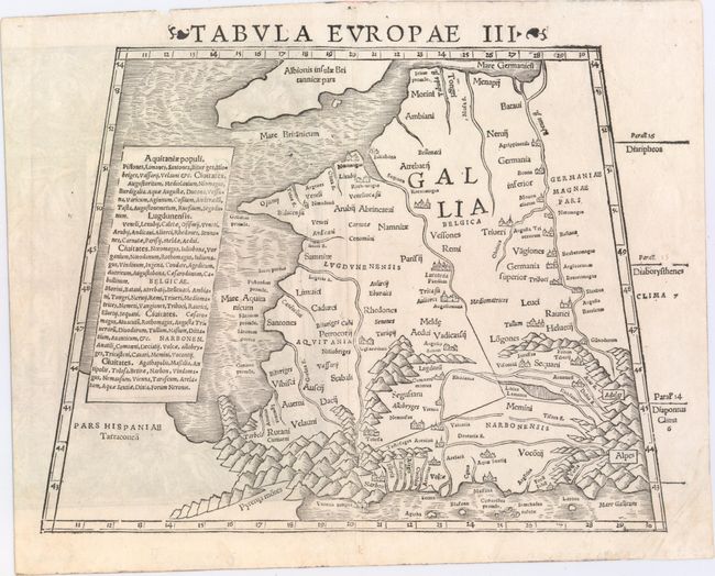
Subject: Western Europe

Period: 1552 (circa)

Publication: Geographia Universalis…

Color: Black & White

Size:
13.3 x 10.8 inches
33.8 x 27.4 cm
Download High Resolution Image
(or just click on image to launch the Zoom viewer)

This is a woodcut map of France and the Low Countries west of the Rhine river. The map is typically Ptolemaic - set within a trapezoidal frame with rope-like mountain ranges and broad rivers. The place names Parisij and Alpes are recognizable, but many of the other Roman place names are not. Latin text on verso marked page 5.

References:

Condition: A

There is a stain on verso that is just barely visible in the bottom right corner of the map image, else fine.

Estimate: $250 - $300

Sold for: $150

Closed on 11/20/2013

Archived