Subject: Utrecht, Netherlands
Period: 1628 (dated)
Publication:
Color: Hand Color
Size:
19.3 x 14.8 inches
49 x 37.6 cm
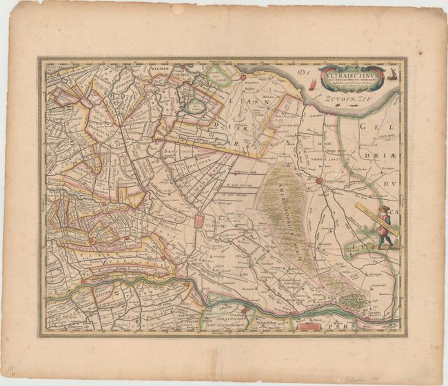
This detailed map centers on the province of Utrecht and its surroundings, showing some cities as miniature plans as well as many towns, rivers, roads, canals, and various topographical features. The Utrecht Hill Ridge (here labeled as Amers Foorder Berch) features prominently east of the city of Utrecht, and the Rhine flows along the bottom of the map. At top right, a couple sailboats appear in the Zuiderzee along with a decorative title cartouche, and a man in local dress carries a distance scale near the Utrecht-Gelderland border. Engraved by Evert Sijmonszoon Hamersveldt. French text on verso.
References: Van der Krogt (Vol. I) #3660:1.1.
Condition: B+
This example has old color and sizable margins as well as light scattered foxing. There are several short tears along the sheet's edges and centerfold separations at top and bottom, none of which enter into image.