Subject: Scandinavia
Period: 1765-78 (circa)
Publication:
Color: Hand Color
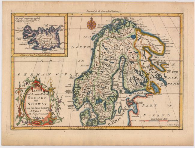
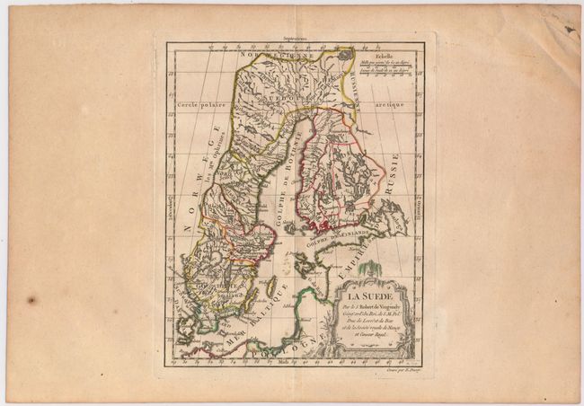
A nice duo of eighteenth century maps of Scandinavia, both filled with details of towns, political boundaries, rivers, and topography.
A. A New and Accurate Map of Sweden and Norway from the Sieur Roberts Atlas with Improvements, by John Gibson, from Geographical Dictionary, circa 1765 (11.3 x 7.7"). Gibson's map includes an inset of Iceland, a compass rose capped with a fleur-de-lis, and an ornate title cartouche. Condition: A few tiny spots. (A)
B. La Suede, by Didier Robert de Vaugondy, circa 1778 (7.5 x 9.4"). This is the second state. Reference: Pedley #66. Condition: This example has wide margins as well as some printer's ink residue and a few errant spots of color. (B+)
References:
Condition:
See description above.