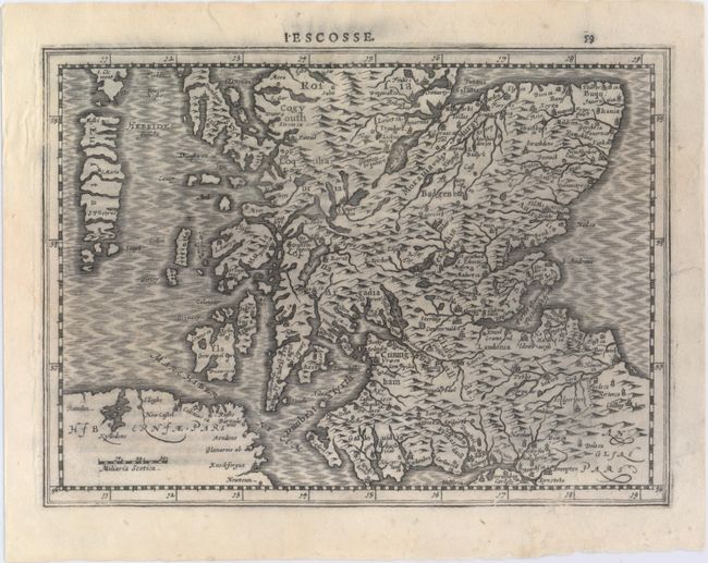
Subject: Southern Scotland
Period: 1734 (circa)
Publication: Sauzet's Atlas Portatif
Color: Black & White
Size:
9.7 x 7.1 inches
24.6 x 18 cm
This charming little map of Scotland extends to the Outer Hebrides and depicts major towns, including Edinburgh and Glasgow, and key topographical features. This map was first published in 1630 by Jan Cloppenburgh in Dutch, who based these reduced-size maps after those by Mercator/Hondius. This example was issued a century later with French text by Henri du Sauzet. The number "59" is shown above the plate mark at top right.
References: Shirley (BL Atlases) #T.SAUZ-1a; cf. Shirley (BL Atlases) #T.CLOP-1a; Moir, pg. 184.
Condition: B+
A dark impression with one small abrasion in the lower border and a tear that just touches the neatline at right that has been . There are separations along the plate mark at left that have also been closed on verso with archival tape.