Subject: Britain
Period: 1679 (circa)
Publication:
Color: Hand Color
Size:
21 x 17.8 inches
53.3 x 45.2 cm
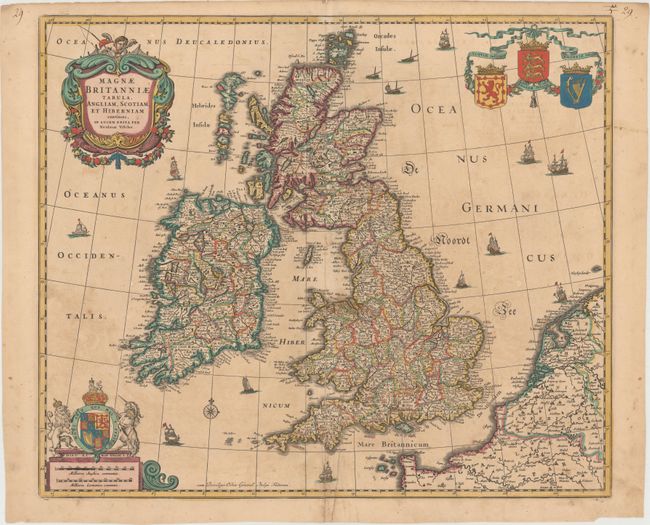
This spectacular map of the British Isles expands on the half-century-old plate of Visscher's father, Claes Janszoon, to include the Orkneys, more of inland Europe, and new cartouches. The UK is shown in magnificent detail, with many towns, cities, and shires identified. A putti with a fishing rod looms over the decorative title cartouche in a nod to Visscher. Another cartouche at bottom left houses two distance scales and is capped by the royal coat of arms for the United Kingdom. A compass rose, the individual coats of arms for Scotland, England, and Ireland, and several sailing ships fill the seas. This is the fifth state, likely issued after Visscher's death by his son.
References: Shirley (BI to 1750) Visscher 1, state 5.
Condition: B
Light toning. There are several small centerfold separations at bottom and two small abrasions in unengraved areas, all of which have been repaired with archival material on verso.