Subject: North Atlantic
Period: 1728 (published)
Publication: Atlas Maritimus & Commercialis
Color: Hand Color
Size:
23.5 x 19.5 inches
59.7 x 49.5 cm
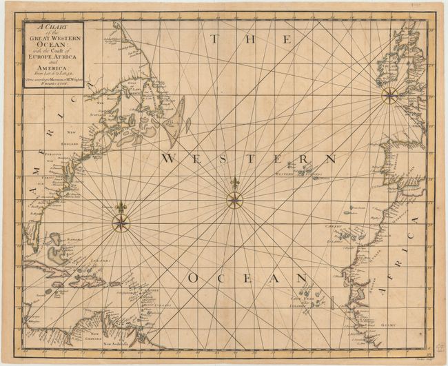
This handsome sea chart of the north Atlantic Ocean depicts the surrounding countries with numerous place names along the coasts. There is good detail of islands, banks and shoals, to aid in the navigation of ships crossing the Atlantic. The chart is decorated with three compass roses with fleur-de-lys pointers and radiating rhumb lines. Although the chart is typically credited to John Senex, it was most likely engraved by Samuel Parker, whose imprint appears at bottom right. This chart appeared in Edmond Halley's Atlas Maritimus & Commercialis, with text by Halley, Daniel Defoe and Nathaniel Cutler, and published by J. & J. Knapton. Edmund Halley (1656-1742) was an English astronomer, meteorologist, and physicist best known for calculating the orbit of the eponymous Halley's Comet. In 1686 Halley became the first to depict trade winds and monsoons on a map, which appeared on his untitled diagrammatic world map. Halley was granted temporary Captainship in the Royal Navy for his scientific voyage through the Atlantic on the ship Paramore, during which he investigated the laws governing the variation of the compass.
References: Shirley (BL Atlases) M.HALL-1a #49.
Condition: B+
A fine impression with light toning, offsetting, and a few small, minor spots. There are professional repairs to a centerfold separation that enters 1/2" into map at bottom and two small worm tracks confined to top blank margin.