Subject: Falkland Islands
Period: 1770 (dated)
Publication:
Color: Hand Color
Size:
27.4 x 17.7 inches
69.6 x 45 cm
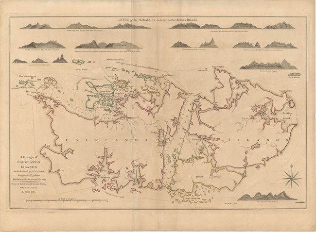
This chart depicts the routes of the British ships HMS Carcass and HMS Jason during their survey of the Falkland Islands in 1766. The two northwestern-most islands were named after the two vessels. A few English and French settlements are shown, and the islands are surrounded by depth soundings, anchorages, rocks, and shoals. Above and at bottom right are 9 coastal approach views of the Jason Islands, formerly called the Sebaldine Islands by the Spanish. The map is based on a chart by Captain Macbride, who commandeered the HMS Jason and published an account of the survey in A Journal of the Winds and Weather ... at Falkland Islands in 1767.
References: Fordham (MCC-11) #7.
Condition: B
Original color on watermarked paper with light toning and offsetting, some soiling, and an extraneous crease running adjacent to centerfold.