Catalog Archive
Auction 147, Lot 345

"Tafelein Anzeigend den weg, wie die Hollandische Flotta von dem Hafen zu Callao…", Bry, Theodore de

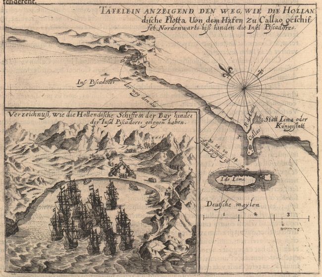
Subject: Lima & Callao, Peru

Period: 1634 (circa)

Publication: Decima Tertia Pars Historiae Americanae

Color: Black & White

Size:
7.1 x 6.1 inches
18 x 15.5 cm
Download High Resolution Image
(or just click on image to launch the Zoom viewer)

Map of the seacoast south of the port of Lima and north of the bay near the Pescadores Islands. Coastal topography, soundings off the shore, and a compass rose capped with a fleur-de-lis and radiating rhumb lines are shown. An inset depicting a Dutch fleet in the bay east of the Pescadores Islands appears in the left corner. On a sheet of Latin text (9.3 x 13.3"). Published by Merian.

References:

Condition: A

Minor show-through of text on verso and some faint offsetting, a few wormholes, and several short tears along the sheet's edges, all well away from image.

Estimate: $180 - $220

Unsold

Closed on 11/20/2013

Archived