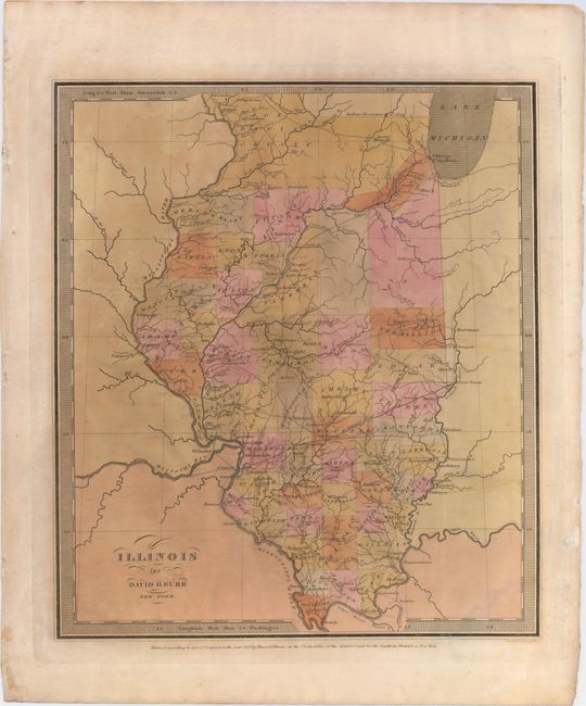
Subject: Illinois
Period: 1834 (dated)
Publication: Burr's New Universal Atlas
Color: Hand Color
Size:
10.8 x 12.3 inches
27.4 x 31.2 cm
This is Burr's first edition map of the state. Filled with many interesting details including place names, counties, rivers, forts, a proposed canal from Lake Michigan to Peoria, and the National Road from Terre Haute to St. Louis. Ristow states that Burr had managed to copyright only eight of the maps needed to complete his world atlas before being appointed as topographer of the U.S. Post Office Department in 1832. The rest of the maps were completed by the firm of Illman & Pillbrow, and published by D.S. Stone, New York in 1835.
References: Phillips (A) #771; Ristow pg.106.
Condition: B
Original color with some minor oxidation of the pigment with light toning on verso.