Subject: Colonial Mid-Atlantic
Period: 1757 (published)
Publication: London Magazine
Color: Black & White
Size:
8.9 x 6.5 inches
22.6 x 16.5 cm
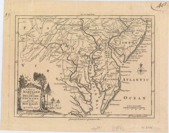
A wonderful example of this map which describes the Mid-Atlantic region during the French and Indian Wars. Centered on Annapolis, the map includes all of Delaware, Maryland, and the Chesapeake (here Chesopeak) Bay, with parts of New Jersey, Pennsylvania, and Virginia. The map is very crisply detailed with roads, portages, forts, towns and villages, watershed, and mountains. A surprising number of wagon roads fill the map, extending as far west as Cumberland Fort. Locates Harper's Ferry, Standing Stone, The Meadows, a town simply called "Dick's", Port Tabacco, several forts, and more. In the western frontier there are several settlements including Crasson, Rays T., Enoch's, Nevil's Orchard, etc. The map was printed for R. Baldwin in Pater Noster Row, and appeared in the August 1757 issue of the London Magazine. As was the practice of the day, longitude from Philadelphia is noted at top, and from London along the bottom. The rococo-style title cartouche includes a scene with birds, forest, and hunters.
References: Jolly #LOND-122.
Condition: A
A dark impression on watermarked paper with tiny binding holes in the blank margins.