Catalog Archive
Auction 147, Lot 152

"Carte de la Nouvelle Angleterre, Nouvelle York, Nouvelle Jersey, et Pensilvanie", Bertholon, C.

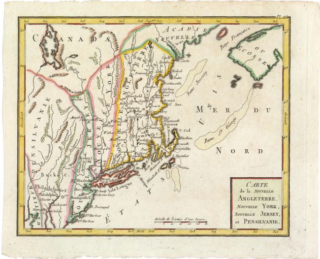
Subject: New England and Mid-Atlantic

Period: 1799 (circa)

Publication: Atlas Moderne Portatif…

Color: Hand Color

Size:
8.5 x 6.8 inches
21.6 x 17.3 cm
Download High Resolution Image
(or just click on image to launch the Zoom viewer)

This interesting map of New England exhibits some very odd boundaries. The states appear as amorphous strips stretching north-south displaying the lack of French knowledge of the existing boundaries. In New England, Massachusetts Bay and New Hampshire seem to have been added to the plate, and are spelled Massachusset Bey and Hew Hampshire. The map is a close copy of Joseph La Porte's 1780 map of the same title, with a simplified cartouche and the change of Possessions Angloises in the Atlantic to Etats Unis reflecting the French support for American independence.

References: cf. McCorkle #780.2.

Condition: A

Watermarked paper with very minor soiling.

Estimate: $200 - $250

Sold for: $100

Closed on 11/20/2013

Archived