Catalog Archive
Auction 147, Lot 142

"United States", Chambers, William & Robert
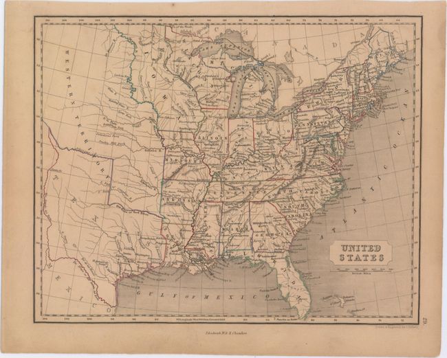
Subject: Eastern United States

Period: 1845 (circa)

Publication:

Color: Hand Color

Size:
10.3 x 8.3 inches
26.2 x 21.1 cm
Download High Resolution Image
(or just click on image to launch the Zoom viewer)

This map of the eastern United States extends into the Great Plains here labeled Western Territory. Texas is shown in its stovepipe configuration right around the time it became a state as Iowa is still shown as a territory (Iowa achieved statehood in 1846). Wisconsin is depicted with an odd western boundary that follows the Mississippi River above Fort S. Anthony and ends at Lake of the Woods. Drawn and engraved by J. Gellatly and published by William and Robert Chambers in Edinburgh.

References:

Condition: B+

Light even-age toning.

Estimate: $100 - $130

Sold for: $90

Closed on 11/20/2013

Archived