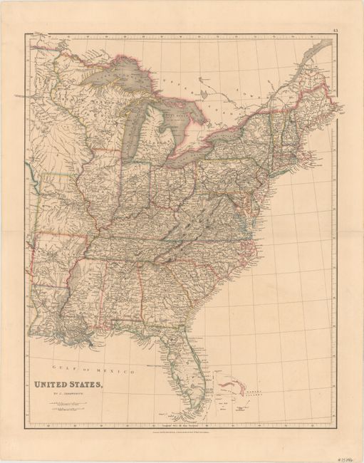
Subject: Eastern United States
Period: 1834 (dated)
Publication: The London Atlas of Universal Geography
Color: Hand Color
Size:
18.8 x 23.5 inches
47.8 x 59.7 cm
This is a very detailed map of the eastern states filled with fine details of roads and early railways. North W. Territory or Huron takes in present-day Wisconsin, part of Minnesota, and the Upper Peninsula of present-day Michigan. West of the Mississippi River are the states of Louisiana, Arkansas and Missouri with the region to the north shown in the possession of the Sioux. Given that Arkansas is shown as a state and Michigan is still a territory, the map is circa 1836.
References:
Condition: B+
Mild toning with fold separations at left and right that enter 1" into the image that have been closed on verso with archival tape.