Subject: United States
Period: 1885-1917 (dated)
Publication:
Color: Printed Color
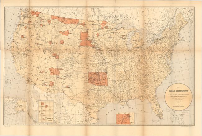
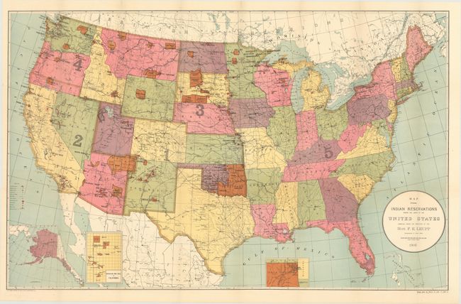
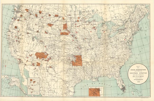
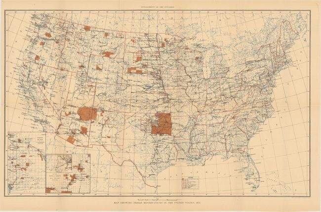
This fascinating set of government maps shows the shrinking Indian Reservations in the United States over a 32 year period, from 1885 through 1917. In addition to the reservations, the maps show military stations, Indian agencies, schools and insane asylums.
A. Map Showing the Locations of the Indian Reservations Within the Limits of the United States and Territories, by Paul Brodie, dated 1885 (33.6 x 21.1"). Condition: Issued folding with several splits at fold intersections and light toning. (B)
B. Map Showing Indian Reservations Within the Limits of the United States, by F.E. Leupp, dated 1905 (33.3 x 21.1"). Condition: Issued folding with a 1/2" binding tear at left that has been archivally repaired. (A)
C. Map Showing Indian Reservations Within the Limits of the United States, by F.E. Leupp, dated 1908 (33.7 x 21.1"). Condition: Issued folding with light toning along several folds and a few tiny splits at fold intersections. (B+)
D. Map Showing Indian Reservations in the United States, by the U.S. Geological Survey, dated 1917 (24.4 x 15.6"). Condition: Faint toning with one short fold intersection that just passes the neatline and has been archivally repaired. (B+)
References:
Condition:
See descriptions above.