Subject: China, Korea & Japan
Period: 1670 (circa)
Publication:
Color: Hand Color
Size:
18.1 x 13.7 inches
46 x 34.8 cm
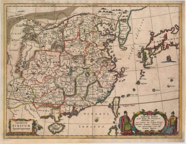
This scarce map of China and Korea is based on the work compiled by Jesuit Father Martino Martini. Father Martini's map was gathered from Chinese sources between 1643 and 1650, and it greatly advanced European knowledge of the region including the correct locations of many cities and topographical features. The trade route between Canton and Peking is noted and the Great Wall and the Gobi Desert are both graphically pictured. This is Kircher's second copperplate engraving, with more decorative cartouches and the same title.
References:
Condition: B
Attractive color on watermarked paper with light foxing and professionally repaired centerfold separations at top and bottom. Remargined on all sides, with borders at left and right skillfully replaced in facsimile.