Subject: Arabia & Middle East
Period: 1753 (dated)
Publication: Atlas Universel
Color: Hand Color
Size:
21.8 x 18.9 inches
55.4 x 48 cm
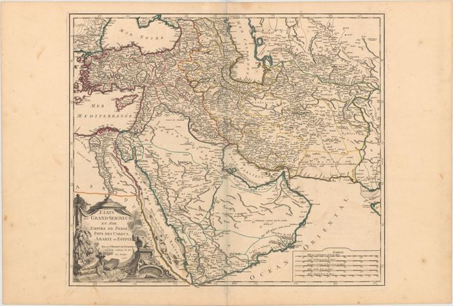
This handsome and detailed map is centered on the Arabian Peninsula, here called Arabie Heureuse. The map shows the Black and Caspian Seas, and extends to include modern Turkey, Persia, Syria, Israel, Saudi Arabia, Iraq, Iran (Persia), Uzbekistan, and much of Afghanistan. A Grand Desert is located between Mecca and Oman, today known as the Rub' al-Khali desert. It provides particularly good detail on the Arabian Peninsula and the Red Sea. The map is adorned with a decorative cartouche showing a Turkish sultan seated on pillows, smoking a long pipe, and five distance scales at lower right. It was published in 1757 as part of the first edition.
References: Pedley #389; Ankary #184.
Condition: B+
Fine original outline color, a sharp impression, and wide original margins with some light soil mostly in the blank margins.