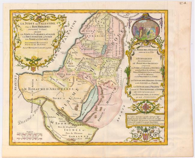
"La Judee ou Palestine, sous le Roi Herodes Surnomme le Grand...", Moullart-Sanson, Pierre
Subject: Holy Land
Period: 1717 (published)
Publication: La Sainte Bible en Latin et Francois
Color: Hand Color
Size:
15.5 x 13.3 inches
39.4 x 33.8 cm
This map shows Israel during the reign of King Herod the Great and its division among his sons after his death. The blank areas on the map are adorned with large, delicately engraved cartouches. The cartouche on the right side includes a vignette of Herod supervising his extensive building project in Jerusalem. Pierre Moullart inherited the copper plates of his grandfather, Nicolas Sanson, and added the Sanson suffix to his name to publish maps. His business was not successful; therefore, his maps are very scarce.
References: Laor #513.
Condition: B+
A nice impression issued folding on bright watermarked paper with minor extraneous creases in the bottom right corner of map and some slight offsetting.