Subject: Spain & Portugal
Period: 1744-1760 (circa)
Publication:
Color: Black & White
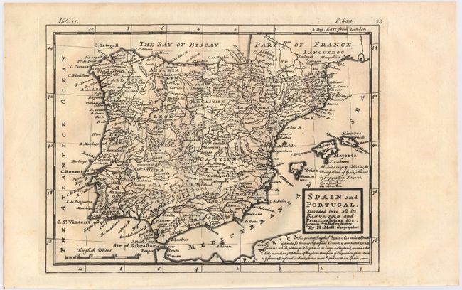
A. Spain and Portugal. Divided Into All Its Kingdoms and Principalities &c. Agreeable to Modern History, by Herman Moll, published 1744 (10.4 x 7.7"). A detailed map of the Iberian peninsula and the Balearic Islands that identifies regions, towns, rivers, mountains, and roads. A notation under the title describes the size and population of Spain. Published in London in Thomas Salmon's Modern History: or the Present State of All Nations. Condition: A dark, but slightly uneven impression.
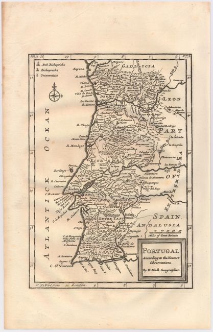
B. Portugal According to the Newest Observations, by Herman Moll, published 1744 (7.0 x 10.0"). This map depicts the entirety of Portugal and names its regions, rivers, major cities and towns, and includes pictorial representations of mountains and forests. A legend in the top left corner identifies arch bishoprics, bishoprics, and universities. Published in London in Thomas Salmon's Modern History: or the Present State of All Nations. Condition: A couple of very faint spots and a slightly uneven impression at bottom right.
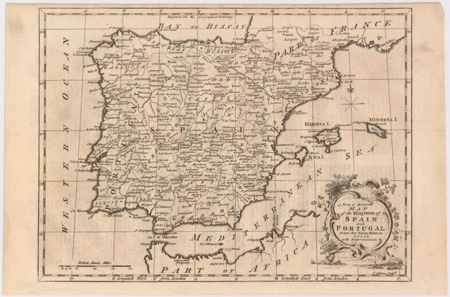
C. A New & Accurate Map of the Kingdom of Spain and Portugal from the Sieur Robert's Atlas, with Improvements, by J. Gibson, circa 1760 (11.7 x 8.6"). Depicts all of Spain and Portugal including portions of southeastern France and northern Africa. Decorated by a fancy title cartouche and distance scale in British miles. Condition: Light offsetting from an opposing page of text. (B+)
References: Shirley (BL Atlases) G.SALM-1c #33 & #35.
Condition: B+
See descriptions above.