Catalog Archive
Auction 146, Lot 512

"Tabula Europae II", Ruscelli, Girolamo

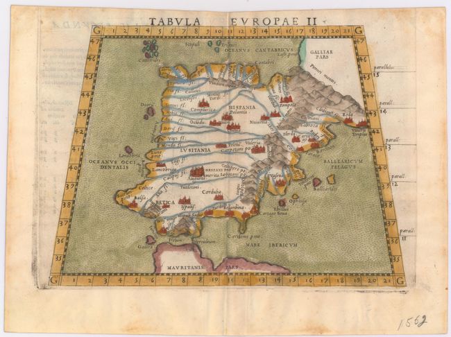
Subject: Spain & Portugal

Period: 1562 (circa)

Publication: La Geografia di Claudio Tolomeo Alessandrino…

Color: Hand Color

Size:
10 x 7.4 inches
25.4 x 18.8 cm
Download High Resolution Image
(or just click on image to launch the Zoom viewer)

This copper engraved Ptolemaic map of Spain and Portugal prominently features the Pyrenees and the rivers of the region. The key cities are marked with miniature castles. The sea is stipple engraved in the Italian style. Latin text on verso. The plate mark runs off the top edge of the sheet, indicating this was published between 1562-64.

References:

Condition: A

A nice impression on watermarked paper with only a hint of toning along the centerfold and marginal soiling. Remnants of hinge tape on verso.

Estimate: $300 - $375

Sold for: $220

Closed on 9/4/2013

Archived