Subject: France
Period: 1684-1874 (circa)
Publication:
Color:
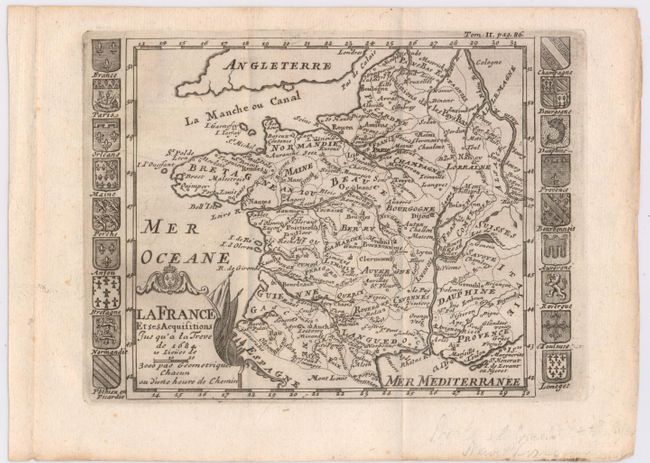
A. La France et ses Acquisitions Jusqu'a la Treve de 1684, by Nicolas de Fer, circa 1700, black and white (7.3 x 5.4"). This map depicts France up until the Truce of Ratisbon, which ended the War of the Reunions between France and Spain. The map is surrounded by coats of arms of provinces throughout France. Condition: Issued folding with a nice impression on watermarked paper. (A)
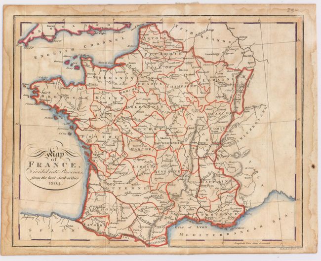
B. Map of France, Divided into Provinces, from the Best Authorities, by Samuel Neele, dated 1804, hand color (9.7 x 7.8"). This map depicts key cities, rivers, and provinces. Condition: Issued folding, now pressed with archival tape reinforcing folds on verso and light damp stains. (B)
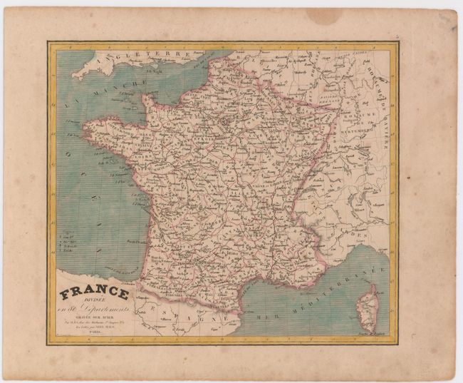
C. France Divisee en 86 Departements, by Charles Monin, circa 1836, hand color (9.2 x 7.9"). This map extends to include Corsica, and identifies cities, departments, archbishoprics, bishoprics, and rivers. Condition: Light soiling. (B+)
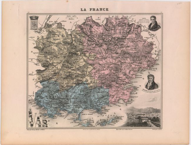
D. La France, by J. Migeon, from La France et ses Colonies, circa 1874, printed color (10 x 8.5"). This map of the department of Var, in southern France, gives good detail of towns, roads, and the topography of the land. The map is surrounded by the coat of arms, two portraits, and a vignette of Draguignan. Condition: Marginal soiling. (A)
References:
Condition:
See description above.