Subject: English Channel
Period: 1695 (circa)
Publication:
Color: Hand Color
Size:
23.5 x 19.8 inches
59.7 x 50.3 cm
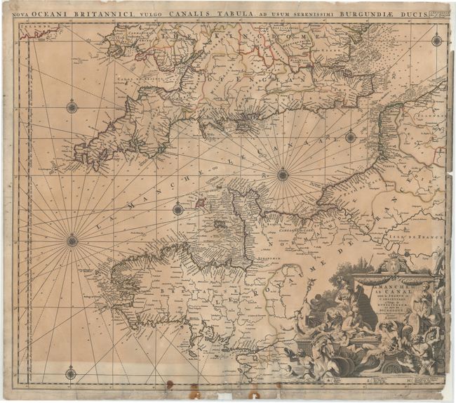
This decorative map of the English Channel gives great coastal detail of southern England and northwestern France with numerous place names, soundings, anchorages, shoals, and other navigational hazards. There is moderate inland detail with towns, rivers, political boundaries, and even battle sites noted. London and Paris are depicted with miniature bird's-eye plans. A large allegorical title cartouche adorns the map, featuring Mercury, Athena, Neptune in his triumphal chariot drawn by hippocamps, putti, and the royal coat of arms of France.
References:
Condition: C+
Original outline color with uneven toning and minor foxing. Backed in heavy tissue to repair several centerfold separations, a long tear that extends from the centerfold just below England to the left margin, and several small chips and tears in blank margins that enter map border.