Subject: Southwestern Netherlands
Period: 1680 (circa)
Publication:
Color: Hand Color
Size:
21.9 x 18.4 inches
55.6 x 46.7 cm
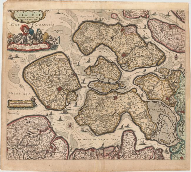
A handsome map of Zeeland detailing the islands of Walcheren, Beveland, Schouwen and Tholen within the Schelde estuary, and Flanders in the south. The map illustrates the topography, roads, town and fortified cities, including Middelburgh, Tolen and Berg op Zoom. Neptune presides over the aquatic-themed cartouche at top and sailing ships navigate among the islands. The title cartouche credits Nicolas Visscher, and the imprint of his father, Claes Janszoon Visscher, appears at bottom right.
References:
Condition: B+
Lovely original color that has been partially refreshed, light soiling, faint scatter foxing, and professionally repaired centerfold separations at top and bottom. There are light damp stains at far right and left, and a few archivally repaired tears in blank margins.