Subject: Netherlands
Period: 1598 (published)
Publication: Theatrum Orbis Terrarum
Color: Black & White
Size:
19.5 x 14.5 inches
49.5 x 36.8 cm
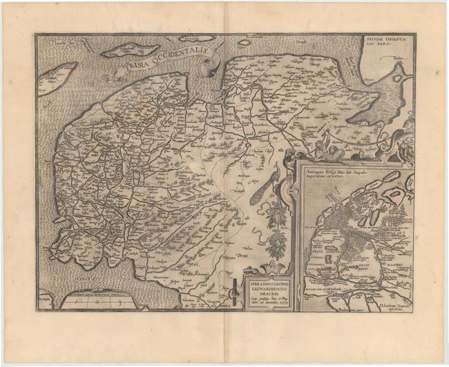
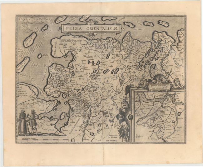
This matched pair of maps show east and west Frisia, both with French text on verso. The map of west Frisia is based on the manuscript map by Sibrandus Leo. A strapwork cartouche featuring a satyr, a peacock and fruit holds an inset of ancient Friesland from Augustus' time. The map of east Frisia depicts the important shipping center of Emden and the Watten Islands, based on the manuscript map by Jon Bloemmaerts or Johannes Florianus. An inset shows the region inundated by the great flood on Christmas Day, 1277, surrounded by an elaborate strapwork cartouche. The map is finely engraved with a stippled sea and a distance scale surmounted by male and female figures displaying the costumes of the region.
References: Van den Broecke #81.2 & 83.
Condition: B
Watermarked paper with wide, original margins and all edges gilt. There are some light damp stains in both maps and some printer's ink residue. The western map also has a 1/2" abrasion near the center of the map.