Subject: Gulf of Mexico & Caribbean
Period: 1740 (circa)
Publication:
Color: Hand Color
Size:
22.9 x 18.9 inches
58.2 x 48 cm
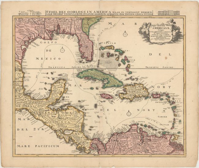
The Ottens brothers based this map of the West Indies on Danckerts' map of the same title. He updated the Gulf Coast and Mississippi River delta based on the important map of Delisle, but the Florida peninsula is filled with spurious mountains. The routes of the Spanish treasure galleons are carefully plotted and there is excellent coastal detail. Two putti support the cartouche in the upper right corner. The Dutch title, "Stoel des Oorlogs in America waar in vertoont werden alle desself voornaamste Eylande nieuwelycks uytgegeven," with a mileage scale and key appear in the top margin.
References: cf. Manasek #64.
Condition: B+
Original color with a few centerfold separations that have been closed on verso with archival tape and a stain below the title cartouche that appears to have been caused by a flaw in the paper. There are two small cracks near the top neatline caused by oxidation of the original green pigment that have also been closed on verso with archival tape.