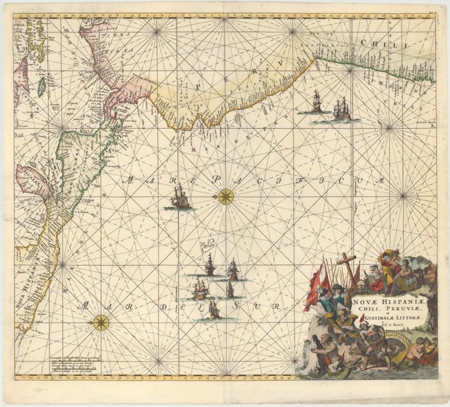
Subject: Central America & Northern South America
Period: 1715 (circa)
Publication: Atlas de la Navigation et du Commerce…
Color: Hand Color
Size:
21.8 x 19 inches
55.4 x 48.3 cm
This handsome sea chart focuses on Central America and the Pacific coast of South America extending to include northern Chili. It also includes part of the Caribbean with the Yucatan, Jamaica, the Caymans and parts of Cuba and Hispaniola. The magnificent title cartouche is filled with allegorical figures and the chart is embellished with rhumb lines, a fleet of galleons and two compass roses. This is the Renard edition of the map that was first published by Frederick de Wit, circa 1675, in Orbis Maritimus ofte Zee Atlas.
References: Shirley (BL Atlases) M.REN-1a.
Condition: B+
A nice impression with some worm holes and tracks along the centerfold that have been professionally repaired with a small amount of image replaced in facsimile.