Subject: Mexico
Period: 1754-84 (circa)
Publication:
Color: Black & White
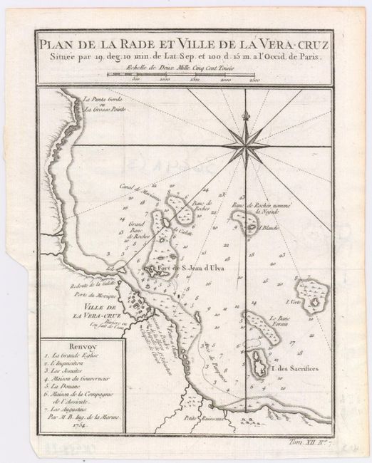
A. Plan de la Rade et Ville de la Vera-Cruz Situee par 19. Deg. 10 Min. de Lat. Sep. et 100 D. 15 M. a l'Occid. de Paris, by Jacques Nicolas Bellin, dated 1754, (6.2 x 8.4"). This attractive copper engraved chart details the fortified city of Vera Cruz and surroundings including the Fort de St. Jean d'Ulua. Outside of the fortified walls are the Redoute de al Galette, Chapelle de St. Sebastien, and the Chapelle de Christ. Seven important features are named and keyed to the map. Soundings and sailing hazards are noted in the bay . Southeast of Veracruz is the Petits Ruisseaux. Large compass rose with rhumblines. Distance scale is incorporated into title block above the map. Condition: Issued folding, but now pressed flat, with just a slight amount of offsetting.
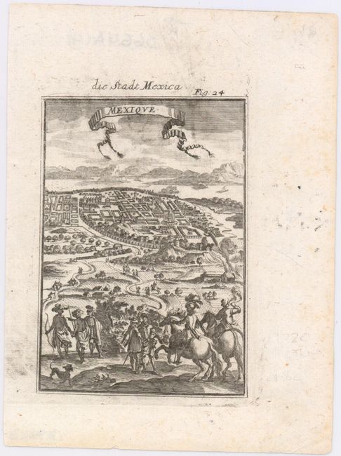
B. Mexique, by Alain Manesson Mallet, from Beschreibung des Ganzen..., published 1784, (3.9 x 5.5"). This terrific bird's-eye view of Mexico City features a scene of conquistadors and natives in the foreground. The title appear in a ribbon-style cartouche, as is typical in Mallet's work. Ref: Pastoureau MANESSON-MALLET 1B (322). Condition: There is minor printer's ink residue that barely affects the image.
References:
Condition: A
See description above.