Subject: Wisconsin
Period: 1836-73 (circa)
Publication:
Color:
This lot of four maps depicting Wisconsin includes:
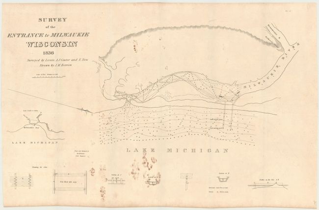
A. Survey of the Entrance to Milwaukie Wisconsin, by U.S. War Department, dated 1836, black and white (23.5 x 14.3"). Shows numerous soundings in the Milwaukee River with a small inset of Milwaukee Bay. Condition: Issued folding with several brown stains in the image. (B)
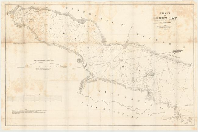
B. Chart of Green Bay, by U.S. War Department, dated 1846, black and white (34.7 x 22.7"). This large map describes the area from Ft. Howard and the village of Green Bay north though Green Bay to its mouth with Lake Michigan to include part of Washington Island. There is good detail along the shoreline with many place names. Bay Settlement, Red Banks with ruins nearby, Little and Big Sturgeon Bays, and much more are located. The extensive soundings and shoreline detail are taken from the 1843 map by Capt. J. McClellans map. The Door Peninsula is shown in its entirety, but with little interior detail. The map is oriented with north to the right. It was made under the assistance of Lieut. J.W. Gunnison, Corps of Topl. Engrs. Gunnison would later perish in 1853 at the hands of Indians near Delta, Utah. Condition: Issued folding with moderate foxing in the upper portion of the image along with a few damp stains. A few fold separations have been closed on verso with archival tape. (B)
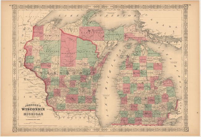
C. Johnson's Wisconsin and Michigan, by A.J. Johnson, dated 1864, hand color (23.0 x 16.9"). Double page map covers both Wisconsin and Michigan with county development shown in full hand color. Condition: Light offsetting and toning along the edges of the sheet. (B+)
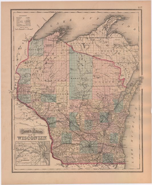
D. Gray's Atlas Map of Wisconsin, by O.W. Gray, circa 1873, hand color (12.4 x 14.9"). Shows county development in the state as well as a portion of the upper peninsula of Michigan. Includes a small inset of Milwaukee at bottom. Condition: Light toning with an edge tear at top that extends 1.5" into the map image and has been closed on verso with archival tape. (B+)
References: Claussen & Friis #195.
Condition:
See descriptions above.