Subject: New York, New York City
Period: 1858-85 (circa)
Publication:
Color:
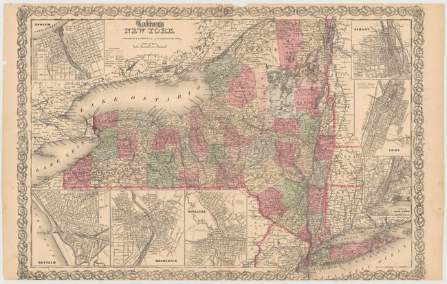
A. Colton's New York, by Joseph Hutchins Colton, dated 1858, hand color (25.2 x 17.0"). Detailed map of New York state with insets of Oswego, Buffalo, Rochester, Syracuse, Albany, Troy and New York City. Surrounded in Colton's distinctive scroll border. The verso is filled with information on the state, population, commerce, etc., updated to 1860. Condition: There is a 1.3" chip in the middle of the image along the centerfold that has been reattached with archival tape on both recto and verso, along with centerfold separations at top and bottom that just enter the image and have also been closed on both recto and verso. Several edge tears confined to the blank margins have been closed on verso with archival tape and the bottom margin has been trimmed to inside the scroll border.
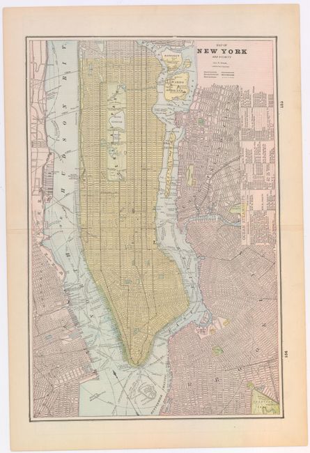
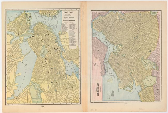
B. Map of New York and Vicinity, by George F. Cram & Co., circa 1885, printed color (12.5 x 18.9"). This attractive map of Manhattan extends from Battery Park to 132nd Street. The city is shown in block format with streets named, along with docks, parks, and numerous ferries located. A good portion of Brooklyn, Long Island City and Hoboken are also depicted. The verso contains maps of Brooklyn and the city of Boston. Condition: The map is clean and bright with a 10" vertical tear along the right center portion of the image that has been closed on verso with archival tape.
References:
Condition: C+
See descriptions above.