Subject: California, Gold Region
Period: 1849-50 (published)
Publication:
Color: Black & White
This lot consists of a pair of uncommon California Gold Rush maps:
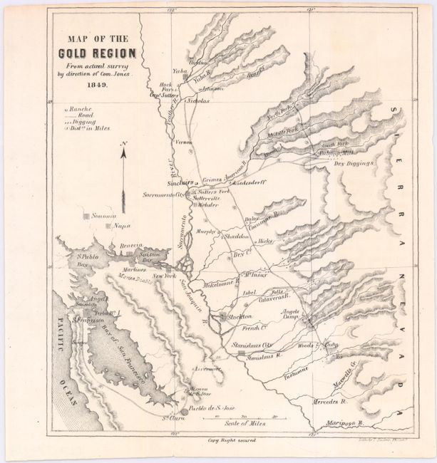
A. Map of the Gold Region from Actual Survey by Direction of Com. Jones, Theodore Johnson, published 1850 (6.0 x 6.8"). This small map displays the early and important gold camps and settlements. It locates Yuba, Capt. Sutters, the Sinclair's, Sacramento City, Sutters Fort, the Culoma Mill, the camps of Murphy, Angels, Mr. Insay, and Dalor to name a few. The map extends to San Francisco with roads leading to the gold regions with distances noted. A legend identifies ranches, diggings and roads. Published in Theodore Johnson’s Sights in the Gold Region and Scenes by the Way. Condition: Clean and bright with a hint of toning at right, a narrow top margin, and small edge tear at top that just passes the neatline.
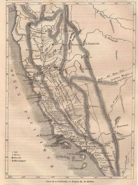
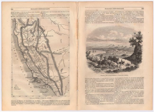
B. Carte de la Californie. - d'apres M. de Mofras, from Magasin Pittoresque, published 1849 (5.9 x 8.1"). This detailed map from Magasin Pittoresque includes 3 pages of related French text with a nearly full page map covering most of California with emphasis on the mining areas around Sacramento. Towns, rivers and topography are depicted with an index at bottom noting gold and silver mines. On full sheet of text (15.3 x 11.0"). Condition: Light toning with some very faint text show-through.
References: Wheat (Gold) #163 & #105.
Condition: B+
See descriptions above.