Subject: Western United States
Period: 1848 (published)
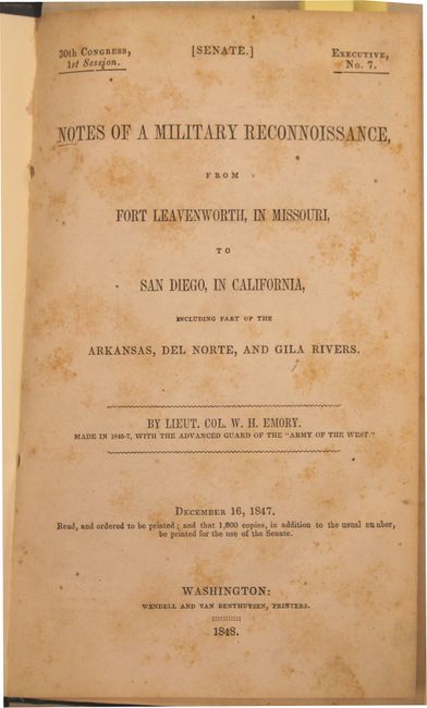
Publication: Sen. Ex. Doc #7, 30th Cong., 1st Sess.
Color: Black & White
Size:
5.3 x 9.1 inches
13.5 x 23.1 cm
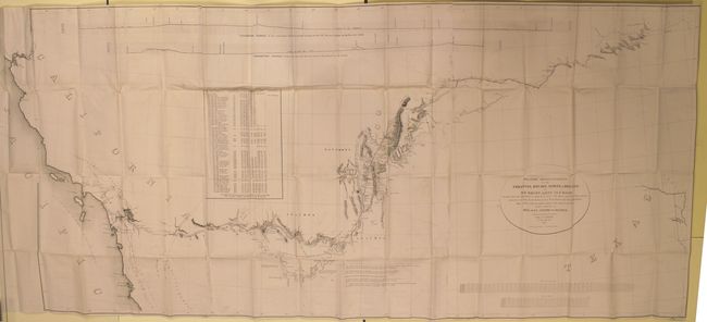
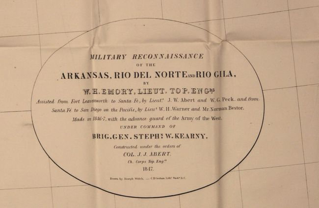
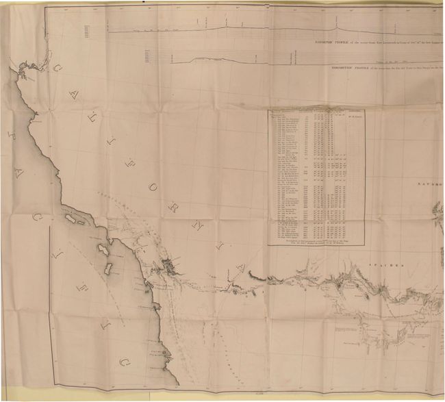
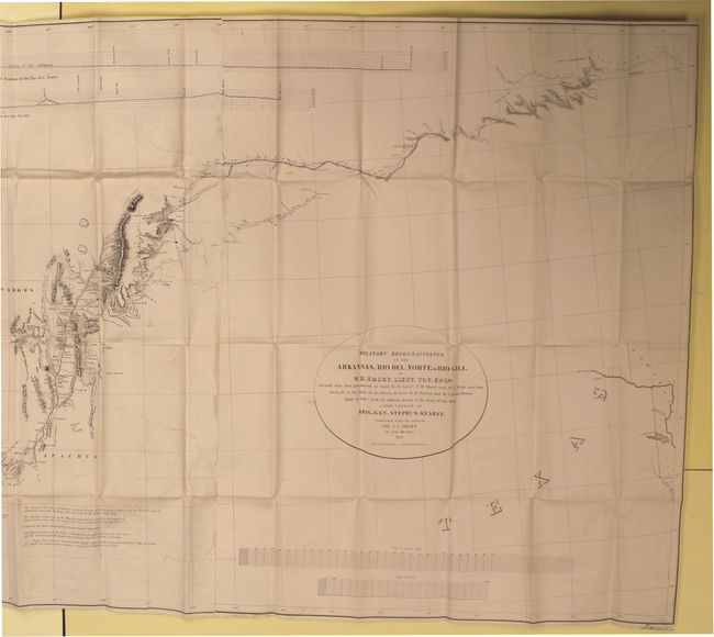
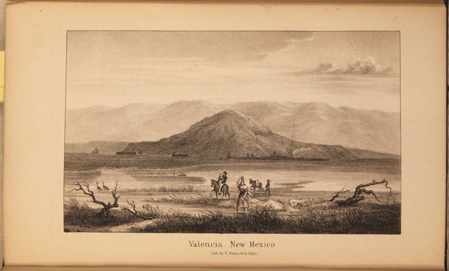
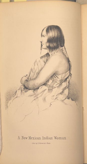
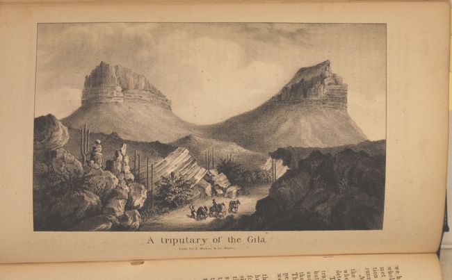
This is the Senate edition of Emory's important report documenting the 1846-1847 journey of the advanced guard of General Kearny's Army of The West. Emory was Brevet Major of the Corps of Topographical Engineers. This report features full-page lithographs of the natives, rivers, landscapes, towns and pueblos, flora and fauna that were encountered during the march to the Pacific. Emory's reports are enjoyable reads and this is no different, with passages such as "I stopped in the little town of Isoletta, to visit my friend, the accolade, who has the reputation, Indian though he be, of being the most honest man and best maker of brandy in the territory."
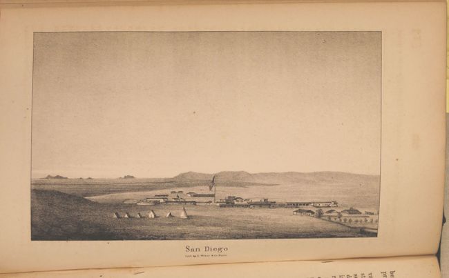
The report summarizes the activity of the U.S. Army of the West after the capture of New Mexico with important early views of the region. It is illustrated with 25 lithographed views, three battle maps, and 14 botanical plates. The view of San Diego is present. The battle plans are: Sketch of the Actions fought at San Pasqual in Upper California…; Sketch of the Passage of the Rio San Gabriel...; and Sketch of the Battle of Los Angeles Upper California. Fought between the Americans and Mexicans Jany. 9th, 1847. The report also includes an important Mexican-American War period map entitled Military Reconnaissance of the Arkansas, Rio del Norte and Rio Gila (64 x 30") that shows the route of Col. Kearny and his Army of the West as they traveled from Ft. Leavenworth to Los Angeles via Santa Fe and San Diego. Wheat states that the map was an important milestone in the cartographic development and accurate determination of the geography of the West. A large map printed on three sheets, joined as issued.
416 pages + plates and map. 8vo. Rebound in faux black leather with gilt title on spine. Map is housed separately in an attractive black clamshell case.
References: Wheat (TMW) #544; Howes #E145; cf. Wagner & Camp 148:5.
Condition: B
Map is professionally backed in linen to reinforce and repair several areas of loss and long tears in the image. Text and plates show light scattered foxing.