Subject: World
Period: 1590 (circa)
Publication: Cosmographia
Color: Hand Color
Size:
14.2 x 12.2 inches
36.1 x 31 cm
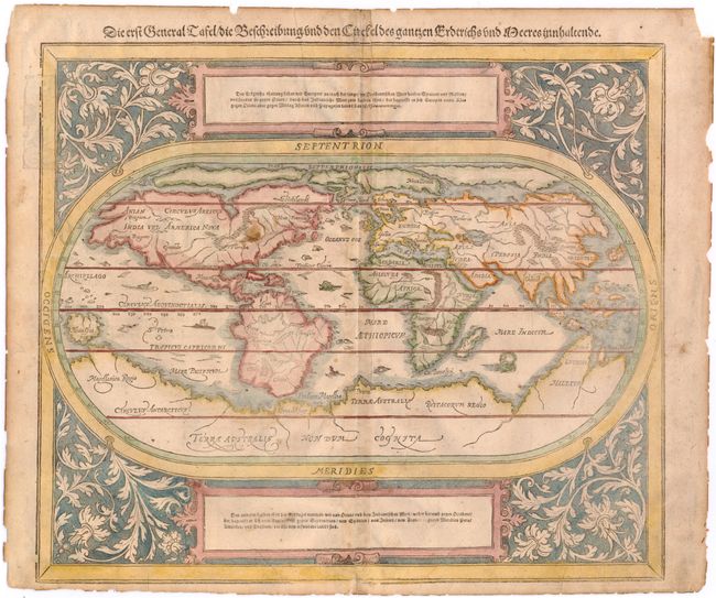
This oval woodcut world map appeared in the later editions of Munster's Cosmographia that were published by his son-in-law, Henricus Petri. The map of the "modern" world is based on Ortelius' map of 1570. It is surrounded by a floral and vine leaf pattern and two strapwork cartouches containing German text. The gothic German title is in the upper margin. Interesting cartographic features of the map include a huge southern continent and a Northern Passage (both Northwest and Northeast) to Asia. The map includes several tiny ships and sea monsters. German text and illustration on verso.
References: Shirley #163.
Condition: C+
There is some soiling, light toning along centerfold, and two printer's creases at bottom. There are two tears that enter 1" into image that have both been closed on verso with archival tape. The sheet edges are a bit brittle.