Subject: North America
Period: 1853 (dated)
Publication:
Color: Hand Color
Size:
83.3 x 78 inches
211.6 x 198.1 cm
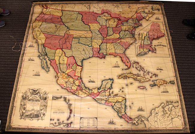
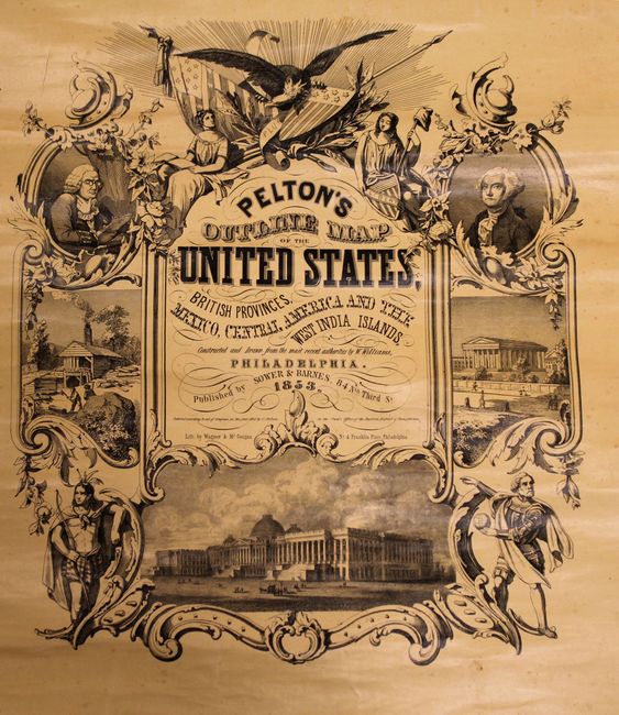
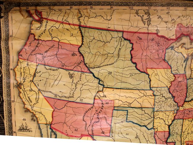
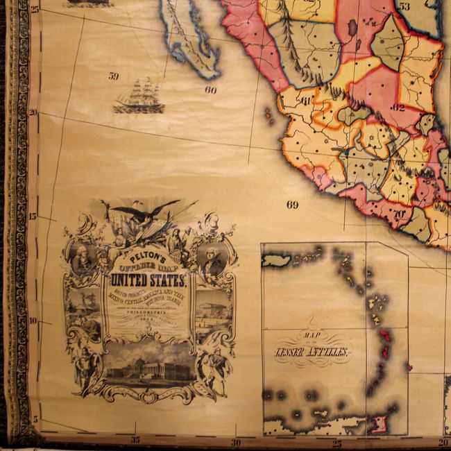
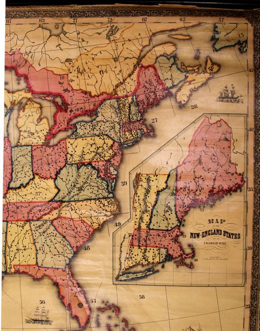
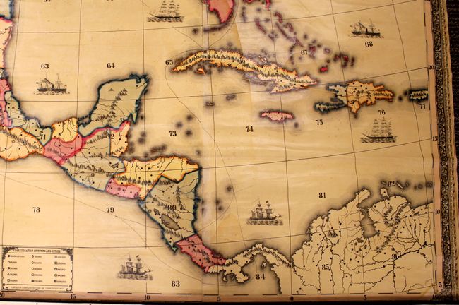
This large wall map of North America was intended for student instruction as it is devoid of place names. In lieu of place names, various locations on the map are numbered 1 to 86 to aid the instructor in quizzing students. The map shows the United States in an early western territorial configuration with a large Utah, New Mexico and Nebraska territory. Oregon and Washington territory extend to the Rocky Mountains, while Utah territory is shown in a post Gadsden Purchase configuration. Includes insets of the northeastern United States and West Indies. A small table at bottom identifies the population size of various cities through symbols. Decorated by an elaborate title cartouche depicting Benjamin Franklin, Christopher Columbus, a Native American, Washington, and various symbols of America including an eagle, shield and Liberty. Surrounded by an attractive floral border and sailing ships in the sea.
Cale Pelton published maps and geography books for schools during the first half of the 19th century, specializing in maps without labels.
References:
Condition: B
Bright, vivid color with some minor cracking at lower right, light toning, and chips in the left blank margin. There are a few damp stains in the upper portion of the blank margin, the cotton ribbon edging is detached along the left side, and the top roller is detached at upper right. Still a very attractive map for this size and age.