Subject: Northwestern Africa & Cape Verde Islands
Period: 1598 (published)
Publication: Caert-Thresoor
Color: Hand Color
Size:
4.9 x 3.5 inches
12.4 x 8.9 cm
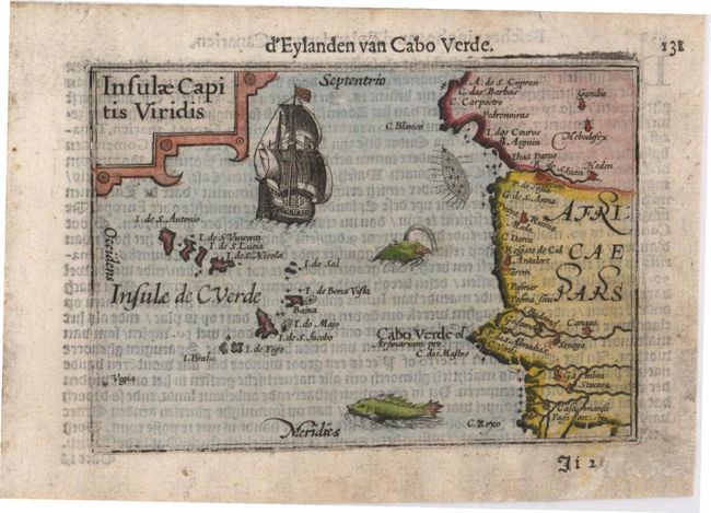
A charming miniature map of the Cape Verde Islands and a portion of the northwestern coast of Africa from Mauritania to Senegal. The map is embellished with a strapwork cartouche, a large sailing ship, and two sea monsters. Though not signed, this map was likely engraved by Petrus Kaerius, who engraved the majority of the maps of the Caert-thresoor (Map Treasury). This is the scarce first state without degrees of latitude in the borders, published by Cornelius Claesz and printed by Langenes. Dutch text on verso.
References: King (2nd ed.) pp. 80-82.
Condition: B+
There is light soiling, show-through of text on verso, and a small chip in bottom right blank margin that has been repaired with old paper.